
GPS and Cable Mapping
 The ITSFM GPS and
Cable Mapping training focuses on the contractor’s responsibility on new projects to furnish as-built plans and other detailed information needed to model ITS components within the ITSFM system. This process was designed to make data collection
efficient while enabling the creation of high-quality, import-ready deliverables.
The ITSFM GPS and
Cable Mapping training focuses on the contractor’s responsibility on new projects to furnish as-built plans and other detailed information needed to model ITS components within the ITSFM system. This process was designed to make data collection
efficient while enabling the creation of high-quality, import-ready deliverables.
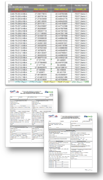
The course is designed to train a three-person crew through classroom and hands-on exercises developed from lessons learned across the state. The crew consists of a crew chief, GPS and cable technicians dedicated to tracing cables and mapping or “as-building” the ITS to determine its condition and actual installed location (Lat/Long), material make-up, quantities, and configuration for input into the ITSFM.
The training teaches field technicians how to work as a team, the proper use of the ITSFM configuration used by the GPS data collector, which ITSFM forms are required, and the process to self-audit each day’s work to ensure high-quality deliverables.
Class Duration
- Three days - Classroom
- Two days - Hands On
Prerequisites
- Previous civil, outside plant telecommunication, surveying or GPS mapping experience.
- Advanced-level computer and field drawing experience.
- Must have a backlog of data available for encoding new or updating existing fiber paths in the production system.
Hardware/Software/Material Requirements
- Trimble Geo7x data collector capable of sub-meter accuracy and equipped with TerraSync 5.85 or newer, laser range finder, camera, and external backpack antenna.
- Underground cable locator.
- Laptop computer equipped with Microsoft Mobile Device Center.
- Licensed Trimble Pathfinder Office, MS Excel, Google Earth.
- Hotspot or another device for Internet connection in the field.
- Mechanical pencil, lead, eraser, 11” x 17” clipboard and general-purpose drawing template.
Laptop Configuration Requirements
- Students MUST verify their laptop computer is properly setup and configuration using the “Job Aid for Testing ITSFM System Config”.
 Internet access.
Syllabus
Module 1 – Introduction and Agenda
Module 2 – Functional Requirements
Module 3 – Naming Standards
Module 4 – Overview of Database Encoding
Module 5 – Introduction to GPS Mapping
Module 6 - GPS Data Collector File Naming
Module 7 – Geo7x/TerraSync Setup and Operation
Module 8 – GPS Feature Mapping
Module 9 – Geo7x Data Transfer
Module 10 – Export and Review
Module 11 – GPS Mapping Quality Review
Module 12 – Fiber Optic Cable Mapping
Module 13 – Detail Site Drawings
Module 14 – Acceptance Testing
This instructor-led training includes the following hands-on exercises are performed throughout the training.
#1 - Preview the data dictionary
#2 – Create mapping file
#3 – Geo7x setup and operation
#4 – GPS feature mapping in the field
#5 – Data transfer
#6 – Export review
#7 – Mapping quality review