
US 41 FRAME
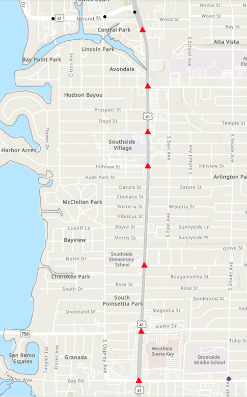
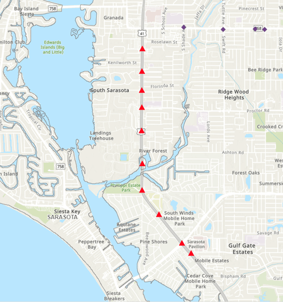
The purpose of the US 41 FRAME project is to deploy emerging safety and mobility solutions such as Automated Traffic Signal Performance Measures (ATSPM) and Connected and Automated Vehicles (CAV) solutions. Applications will include broadcasting map and Signal Phasing and Timing (SPaT) messages, pedestrian safety messages. Equipment will be installed at 25 traffic signals (20 intersections, 5 pedestrian crossings). The corridor is 6.6 miles long, with 21 intersections in a 3.4 mile segment south of the Caloosahatchee River, and 4 intersections in a 2.0 mile segment north of the river. Devices to be installed include CAV roadside units to facilitate communications directly to drivers, CAV onboard units for a small number of Lee County fleet vehicles to gain some insights into the type and quality of data available to the public, video and LiDAR detection for improved vehicle and pedestrian detection within the corridor, and network switch upgrades to allow for the increased bandwidth required for the project.
The goal is to improve safety and mobility within the corridor. This system was operational in summer 2025.
For additional information, please contact Keith Slater at [email protected].