
I-95/SR-9 Multimodal Master Plan
About the Study
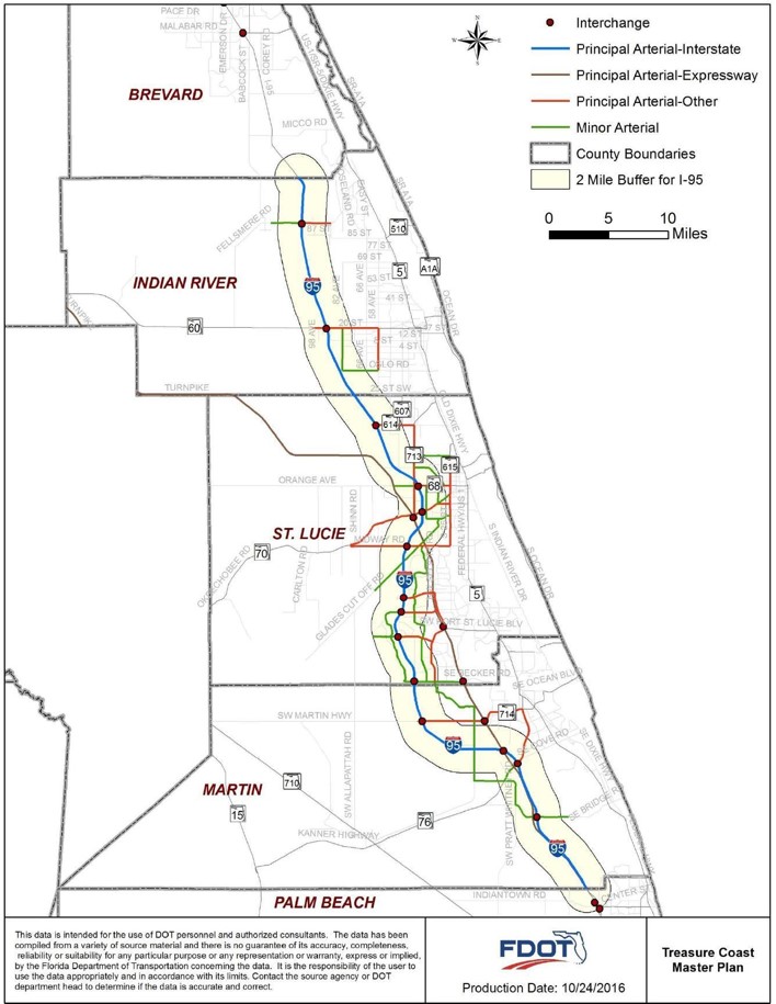
The Florida Department of Transportation (FDOT) will prepare a Multimodal Master Plan for the I-95/SR-9 SIS highway corridor segment, which stretches 71 miles from the Palm Beach/Martin County line to the Indian River/Brevard County line. Improvements to be studied include: roadway widening, interchange modification, innovative design elements, traffic signal and intersection modifications, safety improvements, express lanes, advanced intelligent technology enhancements, park-and-ride lots, bicycle and pedestrian enhancements on cross-streets and public transit enhancements. The project includes large, unincorporated areas (counties) and several municipalities. The local governments and partners on this project with the FDOT are listed below:
- Martin County
- St. Lucie County
- Indian River County
- City of Fort Pierce
- City of Port St. Lucie
- City of Stuart
- City of Vero Beach
- City of Fellsmere
The following interchanges will be studied as part of the I-95 Master Plan.
- Bridge Road
- SR 76/Kanner Highway
- High Meadows Avenue
- SR 714/Martin Highway
- Becker Road
- Gatlin Boulevard/Tradition Parkway
- Crosstown Parkway
- Midway Road
- SR 70/Okeechobee Road
- SR 68/Orange Avenue
- SR 614/Indrio Road
- CR 606/Oslo Road
- SR 60
- CR 512/Fellsmere Road
Click here to view a map of the 62 intersections and cross streets located in the project area. The Master Plan will provide initial preliminary engineering and environmental analysis to evaluate transportation alternatives and recommend improvements to I-95/SR-5 and the supporting local roadway network in the project area.
This particular section of the I-95 Corridor was completed in 1987 and travels through the area that is known as Florida's Treasure Coast. Inside the project limits, I-95 runs primarily west of Florida's Turnpike through Martin and St. Lucie counties, and crosses Florida's Turnpike at State Road 70 (Fort Pierce). From this point, Florida's Turnpike turns west toward Orlando and I-95 continues directly along the coast through Indian River County.
I-95 serves as an emergency evacuation route and connects to other major highways and arterials along the evacuation route.
The counties within the project corridor, especially St. Lucie County, are experiencing growth in population and employment. The U.S. Census designated Port St. Lucie/Fort Pierce as one of the fastest growing metropolitan areas in Florida.
The project is consistent with the goals and objectives of the M/TPOs Regional Long Range Transportation Plan, to provide safe and efficient mobility over the foreseeable future for all users including single- and high-occupancy vehicles, public transportation and the transport of freight and goods.
HOW CAN YOU GET INVOLVED?
Attend a meeting, provide feedback or sign up for news and updates via the project website. Comments and questions are welcomed at
any time throughout the project.