
About SunGuide®
In November 2001, the combined Florida and Michigan Department of Transportation (DOT) Transportation Management Center (TMC) Software Study recommended development of Florida Department of Transportation's (FDOT) SunGuide Software. Development of the software started in October 2003, after an Invitation to Negotiate process was completed. This software enables Florida's TMCs to integrate numerous hardware, software, and network applications as well as exchange data with other TMCs. Because SunGuide standardizes common TMC functions, it helps the various FDOT District facilities become more interoperable so their systems operate better together. The SunGuide Software initially, and continually, leverages Texas DOT's original software investment, reducing Florida's costs.
SunGuide Software is based on an open architecture and enables users to manage multiple subsystems. For example, TMC operators can use the software to perform incident management tasks, obtain data from vehicle detection systems, display videos from roadside cameras, and alert motorists with messages on dynamic message signs and highway advisory radio, or by using the Florida 511 (FL511) advanced traveler information system.
What is SunGuide® Software?
- Facilitate traffic and incident management
- Disseminate traveler information to the motoring public
- Exchange critical information among agencies
- Collect and report data regarding the operation of Florida's transportation system
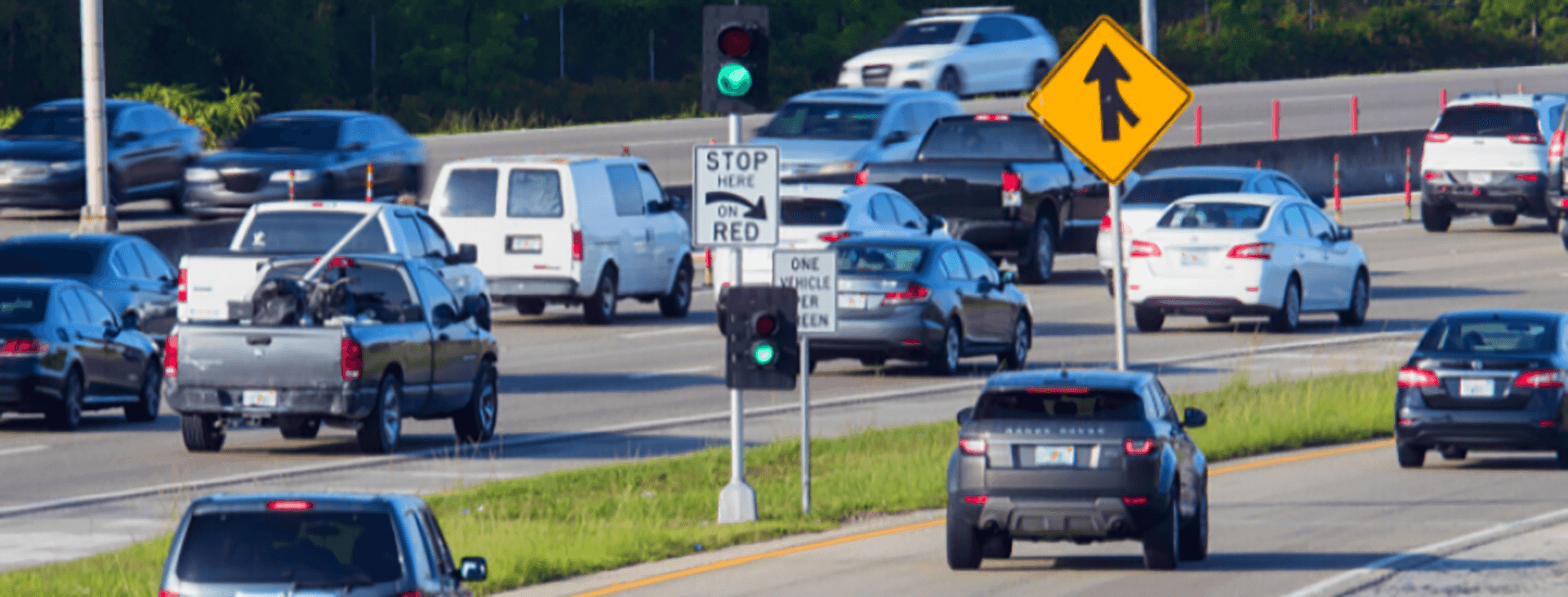
Key Features
- Allows TMC operators to monitor roadside sensors and closed-circuit television cameras to quickly and effectively detect, verify, respond to, and clear incidents
- Provides real-time traffic information to FL511 at www.fl511.com
- Standardizes data exchange between TMCs
- Automates interface with the Florida Highway Patrol's computer-aided dispatch system to receive incident information
- Uses an open architecture, making it easy to add new features
- Complies with state and national standards, lowering costs and risks
- Communicates with Road Ranger service patrol field computers
- Supports Statewide Express Lane Software (SELS) dynamic pricing
- Supports law enforcement with dissemination of AMBER (America's Missing: Broadcast Emergency Response), SILVER, and Florida's LEO (Law Enforcement Officer) alerts via dynamic message signs and FL511
- Communicates with connected vehicle roadside infrastructure to receive traffic information and disseminate traffic advisory messages
Devices Supported by SunGuide® Software
SunGuide Software supports various devices, including:

Dynamic Message Signs (DMS)
Variable Speed Limit Signs (VSL)
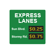
Toll Amount Signs

Ramp Signals

Road Weather Information Sensors

Highway Advisory Radios

Lane Control Signals

Closed-Circuit Television (CCTV) Cameras
Road Sensors/detectors

Video Wall
.png?sfvrsn=db3d9a74_2&Status=Master)
Safety Barriers
Connected Vehicle (CV) Roadside Infrastructure Equipment
What are the Benefits?
- Real-Time Monitoring & Traffic Operations
- Continuous real-time data: SunGuide provides 24/7/365 monitoring of traffic speed, volume, and occupancy, enabling informed decision making and proactive operations management.
- CCTV-based surveillance: RTMC operators use integrated CCTV cameras to quickly detect and verify incidents, accelerating notifications to first responders and the traveling public.
- Unified operations platform: SunGuide consolidates multiple TSM&O modules into a single interface, allowing operators to monitor traffic, control field devices, and manage incidents within one coordinated system.
- Incident Detection, Verification & Response
- Rapid incident identification: Early detection and verification reduce incident clearance time, mitigate congestion, and lower the risk of secondary crashes.
- Automated response plans: SunGuide automatically generates response plans that enable RTMC operators to react to traffic incidents within seconds.
- Enhanced interagency coordination: Integration with local computer-aided dispatch systems streamlines communication and improves multi-agency response efficiency.
- Direct Road Ranger dispatch: Operators can assign Road Rangers from within SunGuide and relay real-time updates to coordinate lane closures, clearance activities, and resource needs.
- Wrong-way driver detection: Integrated wrong-way vehicle detection instantly alerts RTMC staff, enabling rapid activation of response plans and timely warnings to nearby drivers and emergency responders.
- Traveler Information & Communication
- Multi-channel real-time information delivery: SunGuide provides accurate, timely traveler information through:
- Dynamic Message Signs (DMS)
- Connected Vehicle Traveler Information Messages (TIMs)
- FL511 website and mobile app
- Third-party traffic information providers.
- Fast, accurate updates: Continuous communication with Road Rangers and computer-aided dispatch ensures traveler information reflects current conditions, enabling motorists to avoid congestion and choose safer, more efficient routes.
- Multi-channel real-time information delivery: SunGuide provides accurate, timely traveler information through:
- Safety Enhancements
- Reduced secondary crash risk: Effective incident management processes supported by SunGuide decrease the likelihood of secondary collisions.
- Improved responder safety: Faster incident verification, response coordination, and lane blockage updates reduce roadside exposure for first responders.
- Wrong-way vehicle alerts: Immediate notifications protect nearby motorists and help emergency responders take swift action.
- Commercial vehicle safety: The Truck Parking Availability System (TPAS) provides real-time parking availability at rest areas, helping truck drivers identify safe, legal spaces to stop and rest.
- Improved Traffic Flow & Reduced Congestion
- Optimized system operations:
- SunGuide communicates real-time traffic data to Statewide Express Lanes Software (SELS), supporting dynamic toll pricing that helps balance express lane traffic flow.
- Traveler information (e.g., incident and travel-time messages via DMSs and connected vehicle TIMs) enables motorists to avoid congested areas and distribute traffic more efficiently.
- Other SunGuide subsystems that improve operational efficiency include:
- Ramp Meter Subsystem
- Lane Control Subsystem
- Diversion Route Subsystem
- Reduced congestion: Faster incident response, better traveler communication, and active traffic management reduce bottlenecks and improve overall roadway throughput.
- Lower crash risk and emissions: Less congestion results in fewer crashes, decreased fuel consumption, and reduced vehicle emissions
- Optimized system operations:
- Data Analytics & Planning Benefits
- Comprehensive traffic data: Continuous collection of speed, volume, and occupancy data supports performance measurement, operational reporting, planning studies, and long-term research.
- Increased effective capacity: By improving operational efficiency, SunGuide helps maximize the performance of existing roadway infrastructure, reducing the need for costly capacity expansion projects.
SunGuide® Software Development Process
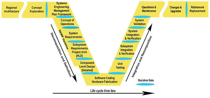
SunGuide® Software Milestones
| Release | Key Features | Release Year |
| 1.x | Initial release with basic ATMS functionalities, such as closed-circuit television camera, dynamic message signs, incident management, message attribution system, traffic sensor system, travel time, video switching, and video wall | 2005 |
| 2.x | Added new subsystems; ramp metering, road weather information sensors, highway advisory radio, safety barrier cable systems, inventory and maintenance, emergency evacuation, and center-to-center plug-in | 2005-2007 |
| 3.x | Enhanced previous release's features and added new subsystems: 511, automated vehicle location/Road Ranger, event management, reporting, variable speed limit, and express lanes | 2007-2008 |
| 4.x | Enhanced travel time, Florida Highway Patrol/computer-aided dispatch, automated vehicle location/Road Ranger, and express lanes | 2008-2010 |
| 5.x | Enhanced operator map, INRIX® integration, smart phone application for Road Rangers, and connected vehicle integration | 2010-2013 |
| 6.x | Enhanced database support, DMS graphics and messaging, scheduled actions, desktop video viewing, AVL updates and alerts, CCTV proximity selection, event and contact management, vehicle alert templates, traffic data validation and averaging, reporting flexibility. | 2013-2017 |
| 7.x | Added the Traffic Controls Subsystem (TCS), Managed Lanes Subsystem (MLS), and Truck Parking Subsystem (TPS); and enhanced Operator Map and administration dialogs, CCTV and ramp metering operations, device and protocol support, traffic and event management, video and DMS functionality, alerts and messaging, travel time handling, permissions and auditing, mapping and visualization, and expanded subsystem integrations across traffic, roadway, and parking operations. | 2017-2020 |
| 8.x | Enhanced event and audit management, DMS, CCTV, video, notifications and reporting, security and permissions, and travel time capabilities; added weather, parking, Wrong Way Driving, and connected vehicle integrations; and modernized UI and workflows, and broader subsystem, protocol, and analytics support. | 2020-2024 |
| 9.x | Enhanced reporting and filtering, device mapping and monitoring, video wall and camera operations, event and alert association, Wrong Way Driving and RWIS capabilities, DMS and RPG logic, C2C data exchange, Road Ranger dispatch and auditing, Flex Lanes and LCS functionality, security and platform upgrades, protocol and driver integrations, status monitoring, user workflow customization, and overall incident, notification, and operational awareness features. | 2024-2027 |
| 10.x (Planned) | Enhancing the system architecture by replacing the Databus with Kafka and RabbitMQ, and adding integrated Geographic Information Systems (GIS) capabilities. | 2027 and later |
SunGuide® Software Deployments
| Deployment Year | SunGuide Software Users |
| 2005 | Jacksonville Regional Transportation Management Center (RTMC) (District 2), Fort Lauderdale RTMC (District 4), Miami RTMC (District 6) |
| 2006 | Traffic Engineering Research Laboratory (Tallahassee, Central Office), Orlando RTMC (District 5), Tampa RTMC (District 7) |
| 2007 | Greater Miami Expressway Agency (GMX), formerly known as Miami-Dade Expressway Authority |
| 2008 | City of Tallahassee (District 3) |
| 2009 | Fort Myers RTMC (District 1), Palm Beach RTMC (District 4), Turkey Lake RTMC (Florida's Turnpike Enterprise), Pompano RTMC (Florida's Turnpike Enterprise), I-595 Express LLC TMC (District 4) |
| 2011 | Central Florida Expressway Authority |
| 2027 | Tampa Hillsborough Expressway Authority |