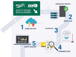
Crash Data Systems and Mapping

This document describes
- When to pull crash data
- How access to crash databases is obtained
- Which crash data sources should be used for analysis
- Which the differences are between the crash databases
- How to pull crash data
- How to define project limits for safety data
- And more..
Fatality Analysis Reporting System (FARS)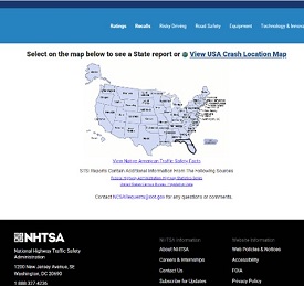
https://www.nhtsa.gov/research-data/fatality-analysis-reporting-system-fars
- Access: Publicly available
- Purpose/contents:
- National high-level overview of historical and trend data
- Provides comparisons between states
- Types of crashes: Fatal traffic crash data only (excludes crashes due to illness, suicide, or on private property)
- Roadway types: All public roadways
- Mapping and/or analytics capabilities: None. Can download tables and charts.
- Latest date of information: It takes 2 years for NHTSA to collect data finalized by states
- Data source: All states (Florida Highway Safety and Motor Vehicles data in Florida)
- Maintained by: National Highway Traffic Safety Administration (NHTSA)
- Advantages: Provides high level statistics and comparisons between states
- Challenges: Data from FLHSMV is recoded for national comparisons and does not align with the timing the FLHSMV official finalization of data.
Florida Highway Safety and Motor Vehicles (FLHSMV) Traffic Crash Facts
https://www.flhsmv.gov/pdf/crashreports/crash_facts_2019.pdf
- Access: Publicly available
- Purpose/contents:
- Florida reports with official crash statistics
- Statewide and county level information
- Types of crashes: All traffic crashes reported by law enforcement that meet long form requirements
- Roadway types: All public roadways
- Mapping and/or analytics capabilities: none
- Latest date of information: It takes a year for FLHSMV to finalize data
- Data source: Crash forms reported by law enforcement agencies
- Maintained by: FLHSMV
- Advantages: Contains official finalized data and statistics for all reported traffic crashes on all roadways. For annual reporting purposes, it is advantageous to use this information.
- Challenges: The finalization process takes a year to complete.
FLHSMV Florida Crash Dashboard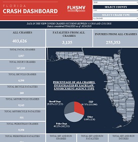
Crash Dashboard - Florida Department of Highway Safety and Motor Vehicles (flhsmv.gov)
- Access: Publicly available
- Purpose/contents: Provides general crash statistics in Florida in visual format with graphs and charts
- Types of crashes: All traffic crashes reported by law enforcement that meet long form requirements
- Roadway types: All public roadways
- Mapping and/or analytics capabilities: User can filter data by year, county, or by pre-selected crash types
- Latest date of information: Refreshes data monthly (it takes agencies up to 90 days to report crashes)
- Data source: Crash forms reported by law enforcement agencies
- Maintained by: FLHSMV
- Advantages: Contains official finalized data and statistics for all reported traffic crashes on all roadways in a dashboard for visualization.
- Challenges: Updated monthly, which may be a challenge depending on what level of timeliness the data is desired to cover.
Crash Analysis Reporting (CAR) System – Reports and Database
https://fdotwp2.dot.state.fl.us/CrashAnalysisReporting/Account/Login
- CAR Online Help User Guide
- Access: Restricted to authorized users, can be granted for FDOT staff, consultants, governmental agencies and Universities, subject to approval by FDOT
- Purpose/contents:
- Statewide database of FLHSMV crash data post-processed by FDOT to provide location coordinates and roadway data that allow users to integrate roadway and traffic characteristics to support safety analyses and studies, systemic crash analysis
- Types of crashes: All traffic crashes reported by law enforcement
- Roadway types: All public roadways
- Mapping and/or analytics capabilities:
- Generates crash summary reports with percentages of contributing factors based on user-defined queries to assist with crash typing analysis
- Provides crash rate analysis to identify focus roadway segments and intersections by crash category on the state highway system
- Allows for export of data and analyses in .pdf, .csv and MS Excel formats
- No mapping capabilities
- Latest date of information: Contains crash data received nightly (it takes agencies up to 90 days to report crashes) FDOT then adds location verification and roadway information for all fatal and serious injury crashes immediately within a week, other crashes post-processed in about 10 months
- Data source: FLHSMV (post-processed by FDOT for location verification and roadway data fields)
- Maintained by: FDOT State Safety Office
- Advantages: The FLHSMV crash data is post-processed by FDOT to provide location coordinates and roadway data that allow users to integrate roadway and traffic characteristics/contributing factors to crashes, to support safety analyses and studies, systemic crash analysis. Fatal and serious injury crashes are post-processed immediately upon receipt from FLHSMV. Database generates summary reports based on user defined queries.
- Challenges: Access is restricted. Does not provide mapping capabilities, or charts and graphs. Over 500,000 crashes per year must be post-processed, so the location verification for non-fatal, non-serious injury crashes may take a few months, which may be a challenge for safety analysis requiring accurate location information for all crash severity levels.
- Addressing this challenge: The data is provided publicly in a GIS layer in the State Safety Office GIS system and FDOT’s Open Data Hub. Currently the CAR System is being upgraded to merge with Signal 4, so the fatal and serious injury level crash locations will soon be immediately available in one system, the speed of the processing of the data will be faster, and the system will allow for the mapping capabilities and the creation of charts and graphs. In the interim, viewing the crash data in both systems allows the ability to leverage the most recent data available in both systems.
Signal 4 Analytics
- Signal 4 Analytics Overview
- Note the user guide is temporarily being hosted on FDOT's website while Signal Four's website is under development
- Access: Restricted to authorized users, can be granted for FDOT staff, consultants, governmental agencies and Universities, subject to approval by FLHSMV
- Purpose/contents:
- Interactive, web-based system to support crash mapping and analysis needs of law enforcement, traffic engineering, transportation planning agencies, and research institutions in Florida
- Preliminary locations shown (not location verified by FDOT)
- Citation data
- Florida Unified GIS Streets
- Local traffic volumes (where available)
- Detailed crash typing information for pedestrian and bicyclist involved crashes
- Types of crashes: All traffic crashes reported by law enforcement
- Roadway types: All public roadways
- Mapping and/or analytics capabilities: Creates charts, graphs, exports to Excel, pdf for further analysis
- Users can select areas/corridors and generate crash summaries and collision diagrams
- Latest date of information: Contains all current crash data received nightly from FLHSMV (it takes agencies up to 90 days to report crashes)
- Data source: FLHSMV crash records
- Maintained by: GeoPlan Center at the University of Florida
- Advantages: Contains all reported traffic crashes on all roadways, including both long and short form crashes, which is updated nightly from FLHSMV. Provides mapping and data query capabilities, and ability to create charts and graphs, and contains detailed bicyclist and pedestrian involved crash details.
- Challenges: Access is restricted. Geographic location information is preliminary and has not yet been verified, which may be challenge for data analysis that relies on accurate location information for crashes of all severity levels. Does not contain additional roadway information to support queries and analysis on roadway related contributing factors.
- Addressing this challenge: There is a publicly available dashboard with high level information and statistics. FDOT verifies all fatal and serious injury level crashes immediately upon receipt from FLHSMV weekly and provides this information in the Crash Analysis Reporting (CAR) System. Currently the CAR System is being upgraded to merge with Signal 4, so this will soon be available in one system. In the interim, viewing the crash data in both systems allows the ability to leverage the most recent data available in both systems.

Signal 4 Analytics Dashboard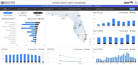
S4Analytics (signal4analytics.com)
- Access: Publicly available, additional queries available with Signal 4 system login access
- Purpose/contents: Provides general crash statistics in Florida from data contained in Signal 4 in visual format with graphs and charts.
- Types of crashes: Fatal and serious injury
- Roadway types: All public roadways
- Mapping and/or analytics capabilities:
- Public version provides ability to sort general statistics by reporting agency, injury level, and Florida’s Strategic Highway Safety Plan emphasis area
- With login, additional queries may be performed: records search, filters based crash form fields, and standard reports supporting the traffic safety challenge for crashes and citations
- Latest date of information: Refreshes data daily (it takes agencies up to 90 days to report crashes)
- Data source: FLHSMV crash records
- Maintained by: GeoPlan Center at the University of Florida
- Advantages: Publicly available and contains dashboard with a visual display of statistics from all reported traffic crashes on all roadways, including both long and short form crashes, which is updated nightly from FLHSMV.
- Challenges: Limited to very high-level statistics for fatal and serious injuries.
State Safety Office GIS (SSO GIS)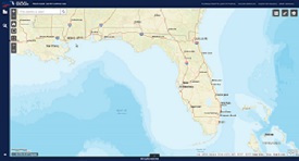
- Access: Publicly available, access to crash report documents restricted to authorized users
- Purpose/contents:
- Map-based interface to provide public access to location verified crash data on public roadways
- Types of crashes: All traffic crashes reported by law enforcement
- Roadway types: All public roads
- Mapping and/or analytics capabilities:
- Performs cluster and heat mapping
- Displays crash locations on map with filter and search functions
- Contains pdf of crash reports, exports Excel and Shape files
- Latest date of information: Displays all location verified data from FDOT: fatal and serious injury crashes which refreshes weekly on weekends (other severity levels post-processed and available within 10 months)
- Data source: Crash Analysis Reporting (CAR) System (FLHSMV data post-processed by FDOT to support safety analyses)
- Maintained by: FDOT
- Advantages: Publicly available mapping and query tool. Contains the FLHSMV crash data post-processed by FDOT to provide location coordinates and roadway data that allow users to integrate roadway and traffic characteristics/contributing factors to crashes, to support safety analyses and studies, systemic crash analysis. Fatal and serious injury crashes are post-processed immediately upon receipt from FLHSMV.
- Challenges: Over 500,000 crashes per year must be post-processed, so the location verification for non-fatal, non-serious injury crashes may take a few months, which may be a challenge for safety analysis requiring accurate location information for all crash severity levels. Does not include short forms and only shows locations that have been post-processed by FDOT.
- Addressing this challenge: Currently the CAR System is being upgraded to merge with Signal 4, so the fatal and serious injury level crash locations will soon be immediately available in one system, and the speed of the processing of the data will be faster.
Open Data Hub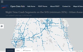
https://gis-fdot.opendata.arcgis.com/
- Access: Publicly available
- Purpose/contents:
- To provide in GIS format for analysts
- GIS data portal for exploring and downloading open geospatial data
- Contains crash data on all public roads in addition to other geospatial data from FDOT SSOGIS
- Types of crashes: All traffic crashes reported by law enforcement
- Roadway types: All public roads
- Mapping and/or analytics capabilities:
- Performs heat mapping
- Overlay GIS layers for visual analysis
- Exports Excel and Shape files
- Can link data to other applications
- Latest date of information: Displays all location verified data from FDOT for fatal and serious injury crashes, refreshes weekly on weekends (other severity levels post-processed and available within 10 months)
- Data source: Crash Analysis Reporting (CAR) System (FLHSMV data post-processed by FDOT to support safety analyses)
- Maintained by: FDOT
- Advantages: Publicly available mapping and query tool, with access to additional data layers for analysis. Contains the FLHSMV crash data post-processed by FDOT to provide location coordinates and roadway data that allow users to integrate roadway and traffic characteristics/contributing factors to crashes, to support safety analyses and studies, systemic crash analysis. Fatal and serious injury crashes are post-processed immediately upon receipt from FLHSMV.
- Challenges: Over 500,000 crashes per year must be post-processed, so the location verification for non-fatal, non-serious injury crashes may take a few months, which may be a challenge for safety analysis requiring accurate location information for all crash severity levels. Does not include short forms and only shows locations that have been post-processed by FDOT.
- Addressing this challenge: Currently the CAR System is being upgraded to merge with Signal 4, so the fatal and serious injury level crash locations will soon be immediately available in one system, and the speed of the processing of the data will be faster.
Thank you to FDOT District One for portions of this page content, adapted from the Safety Academy
Page updated February 18, 2022


