 | Surveying & Mapping Office in Tallahassee, provides statewide administrative, product, and service support for Florida's transportation system. This includes the administration of facilities surveys which involves
providing policies, procedures, guidelines, and training for all surveying and mapping activities. Our Mission is to lead statewide surveying and mapping efforts through spatial technology expertise in support of Florida's
transportation system. Our Vision is to be the leader in transportation surveying and mapping through exceptional performance, customer relations and employee satisfaction. |
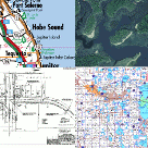
 | Mobile Surveying & Mapping group is responsible for Photogrammetry. They develop statewide policies, procedures, and standards for aerial surveying products for the department and also acquire
and process aerial photography. They support the District Offices in the production of planimetric and topographic mapping and create ortho-rectified and georeferenced imagery and digital terrain models (DTMs). The Aerial Surveying
and Mapping group also provide critical support to the State Emergency Response Team by collecting aerial photography for disaster analysis and mapping.
|
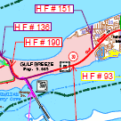
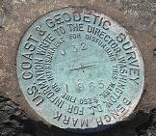 | Location Surveying & R/W Mapping this group develops standards and procedures for the performance of the FDOT Group 8 Surveying and Mapping work types. These work types include:
Geodetic Control Surveys, Design Surveys, Right of Way Surveys, Photogrammetric Mapping, and Right of Way Mapping. The Location Surveying and R/W Mapping group is also responsible for the qualification of consultants performing Group 8 work types on FDOT Projects. They also provide technical support for Surveying and Mapping CADD related issues
as well as field and office survey equipment and related firmware. |