| Horizontal Control | ||
 | Horizontal Control Contact (PDF) | |
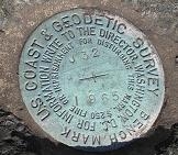
| Vertical Control Benchmark Information | ||
 | Vertical Control Contact (PDF) | |
| R/W Mapping Information | ||
 | Online Right of Way maps R/W Mapping Contact (PDF) | |
| Aerial Photography | ||
 |
| |
Address:
1109 South Marion Ave. 
Lake City, FL 32025
Serving the following counties:
Alachua, Baker, Bradford, Clay, Columbia, Dixie, Duval, Gilchrist, Hamilton, Lafayette, Levy, Madison, Nassau, Putnam, St. Johns, Suwannee, Taylor, and Union.
